
Geoarchaeology
AECOM’s Geoarchaeology Department offers a range of services that utilize the geosciences such as geomorphology, sedimentology, pedology, and geophysics to investigate archaeological sites and their surrounding environs. These avenues of investigation allow us to recreate historical landscapes and environments, identify areas of high and low probability for archaeological sites and features, and determine the spatial and temporal integrity of a site which can be affected by various post-depositional processes.
AECOM’s geoarchaeologists have a wide range of experience conducting geomorphological investigations throughout the Mid-Atlantic region in urban environments, intertidal zones, floodplains, terraces, glacial landscapes, and other upland settings. Surveys are typically conducted through the use of hand-augers, mechanical borings, and/or trenches, depending on the scope of a project. The use of geomorphic assessments early in a project can be a cost-effective method to evaluate the presence or absence of deposits with integrity which allows the archaeologist to focus on areas with the highest preservation potential. Geomorphological investigations can also extend deeper than traditional archaeological survey, allowing for the identification of any deep strata with archaeological potential, buried by anthropogenic, alluvial, colluvial, or eolian processes. A broader geomorphological understanding of the landscape can also assist in developing paleoenvironmental reconstructions and historical changes to the landscape which yields data for assessing site sensitivity and integrity.
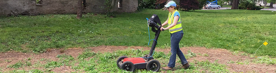
AECOM’s archaeological geophysicists have worked in the Mid-Atlantic and New England regions on a range of sites conducting geophysical prospection using Ground-penetrating radar (GPR) and other remote sensing techniques. Survey sites have included identified cemeteries, unmarked burials, buried structural features, earthworks, battlefields, and other historic sites within both urban and more rural settings. By utilizing these non-destructive survey techniques during site discovery and/or determination of site extent and integrity, archaeological survey can be directed towards targeting high potential areas which allows for potential cost-savings. It also gives an opportunity for construction plans to be modified prior to impacting the resource, allowing for preservation of sites in place without hindering further development.
Project Fact Sheets